
Kuwait Waterfront Public Realm Wayfinding
Kuwait Waterfront.
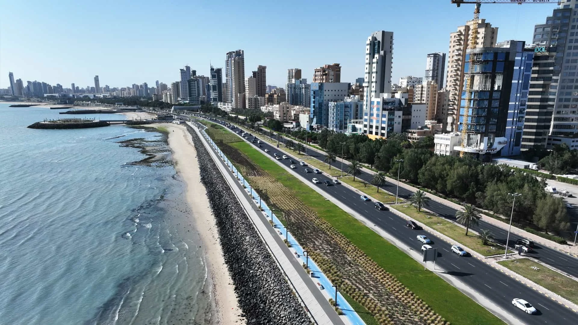
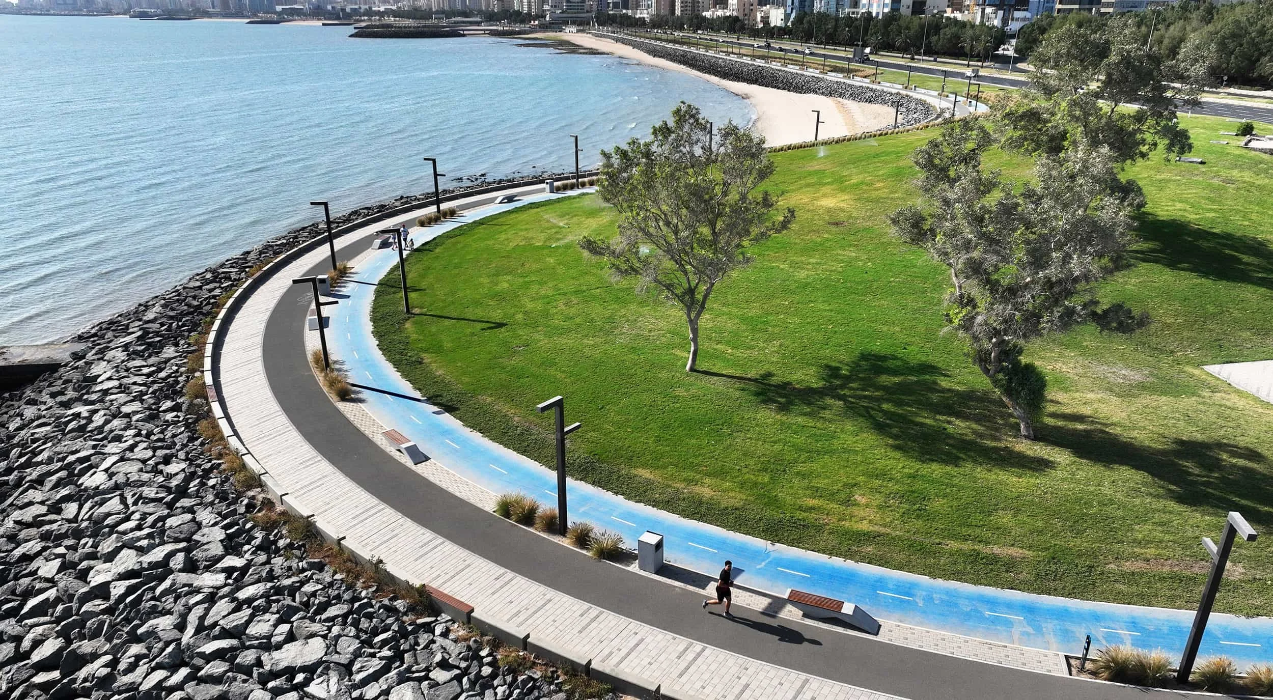
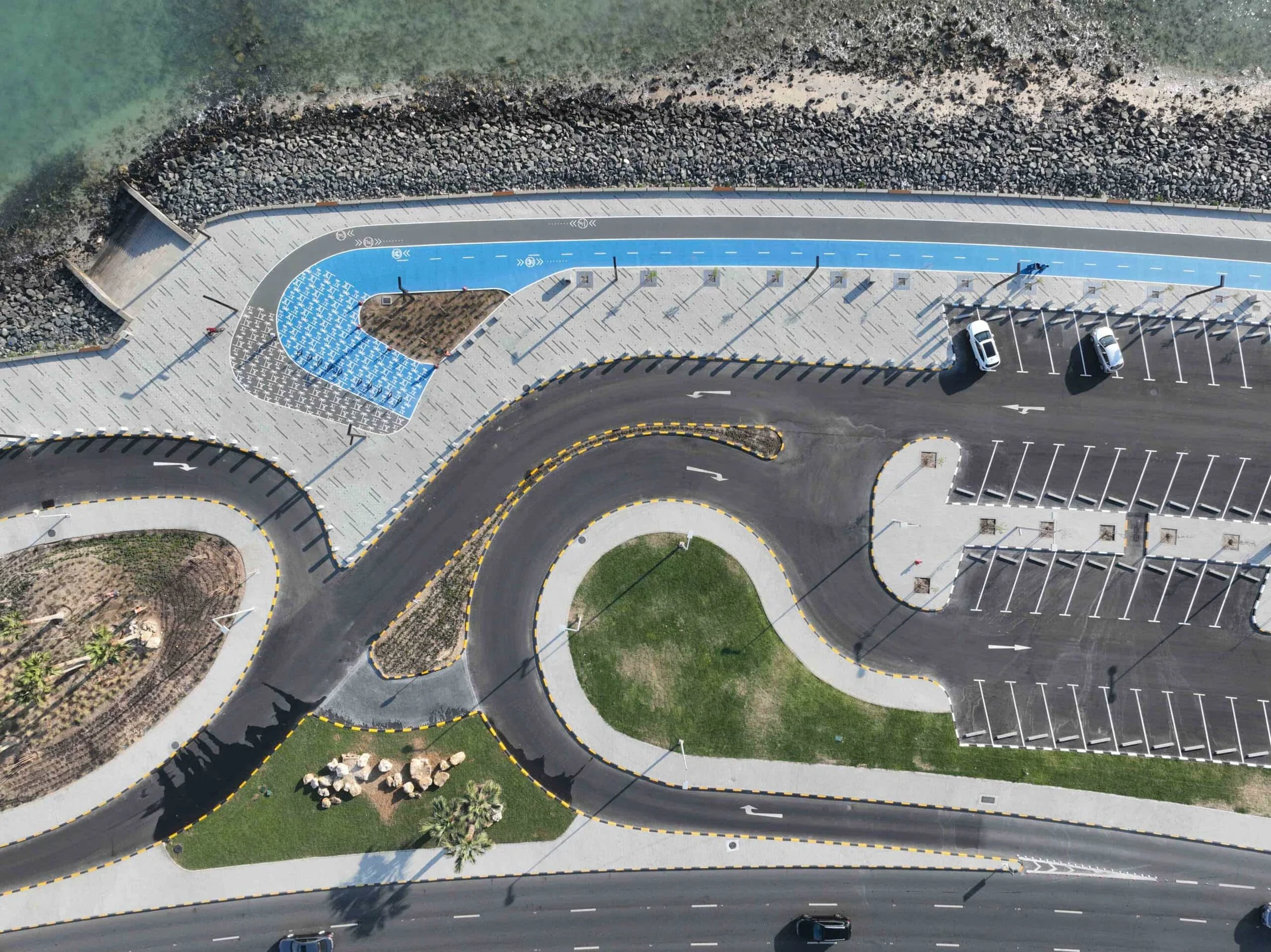
Activating 10 kilometres of the city's iconic waterfront promenade.
Creative Dialog delivered the wayfinding programme for Kuwait City's most iconic public realm asset.
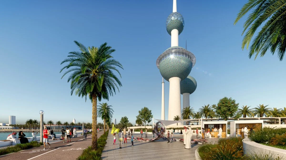
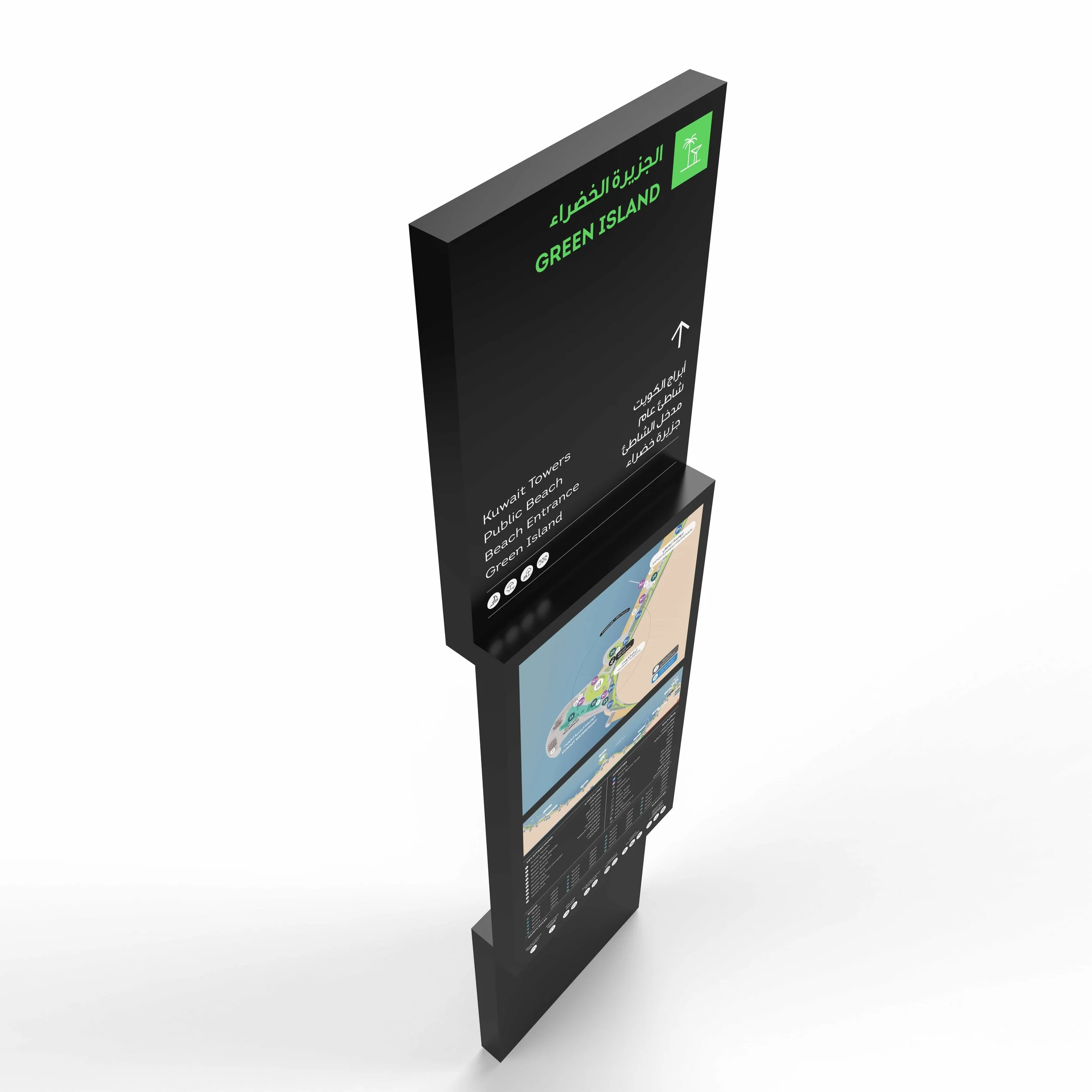
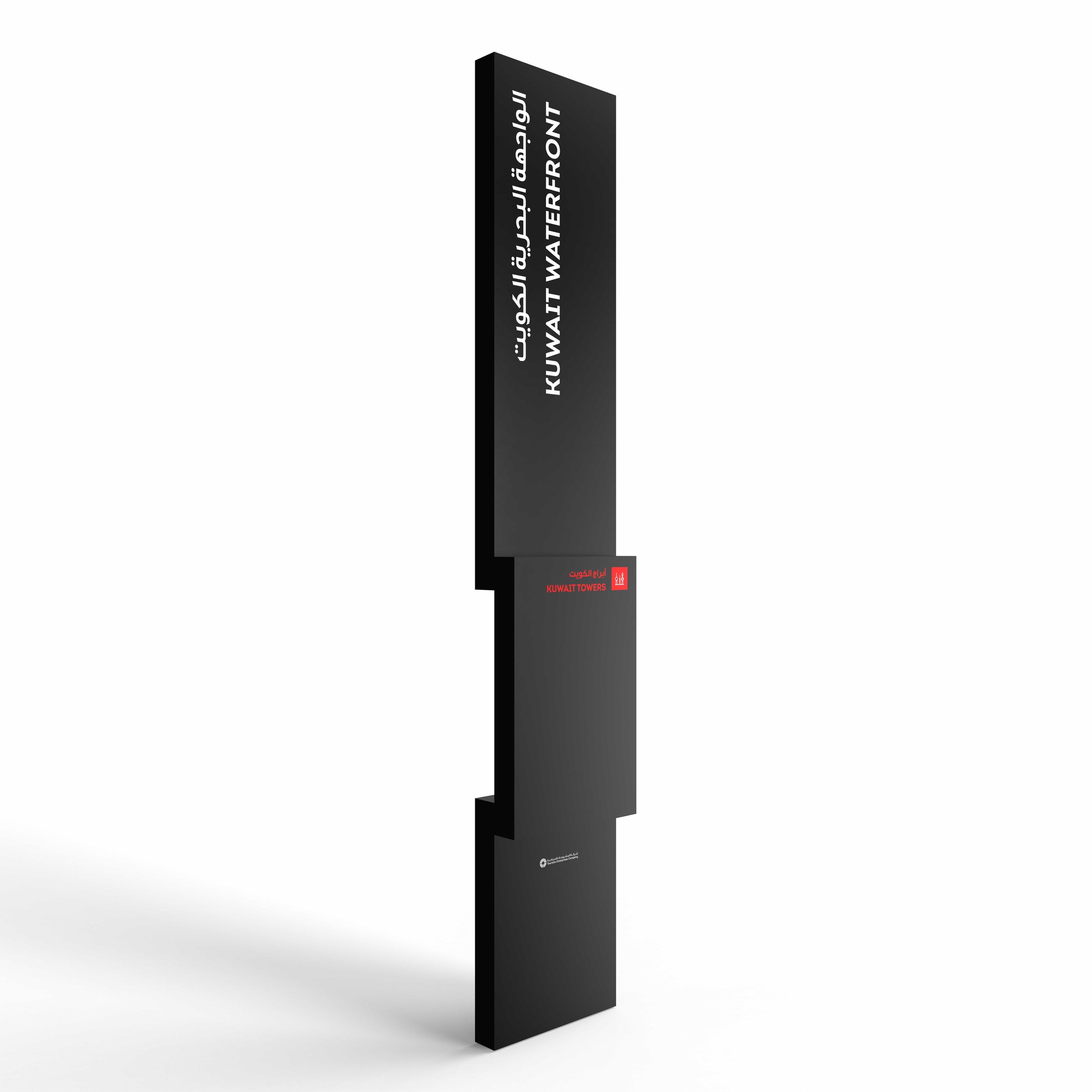
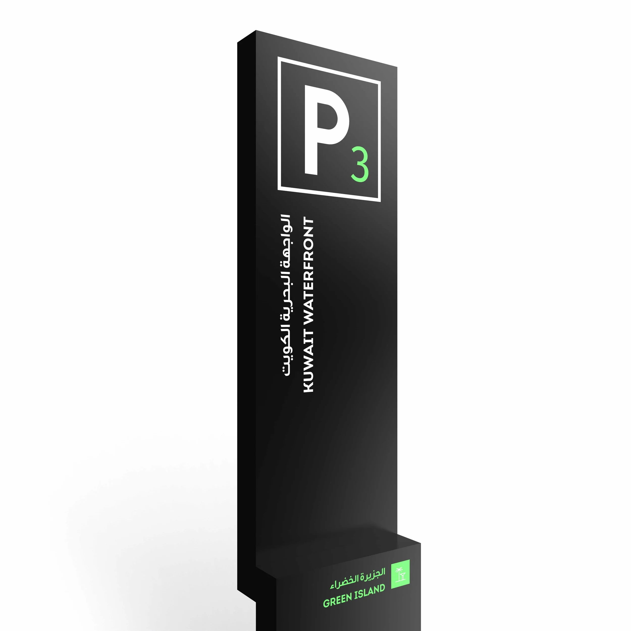
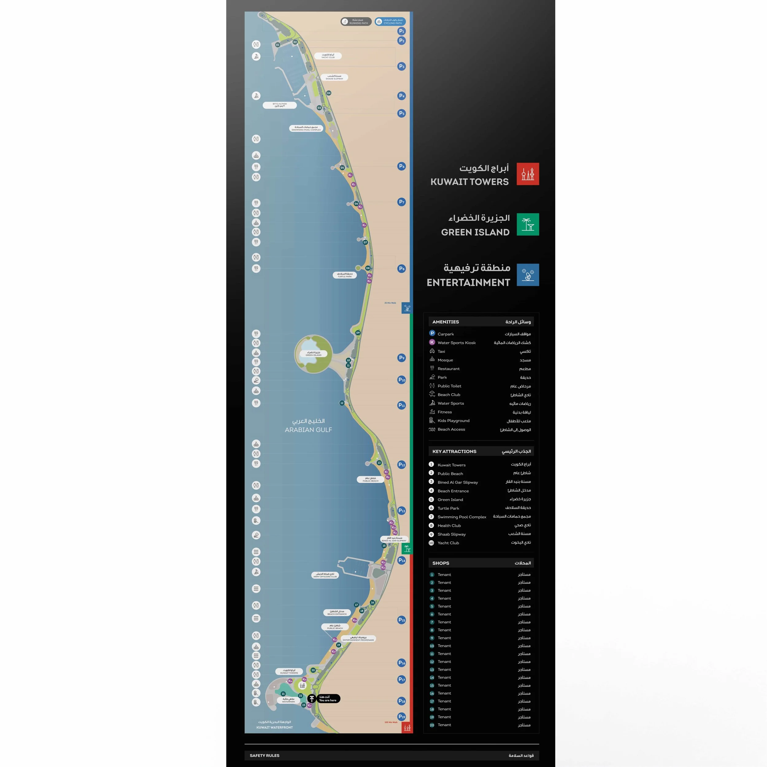
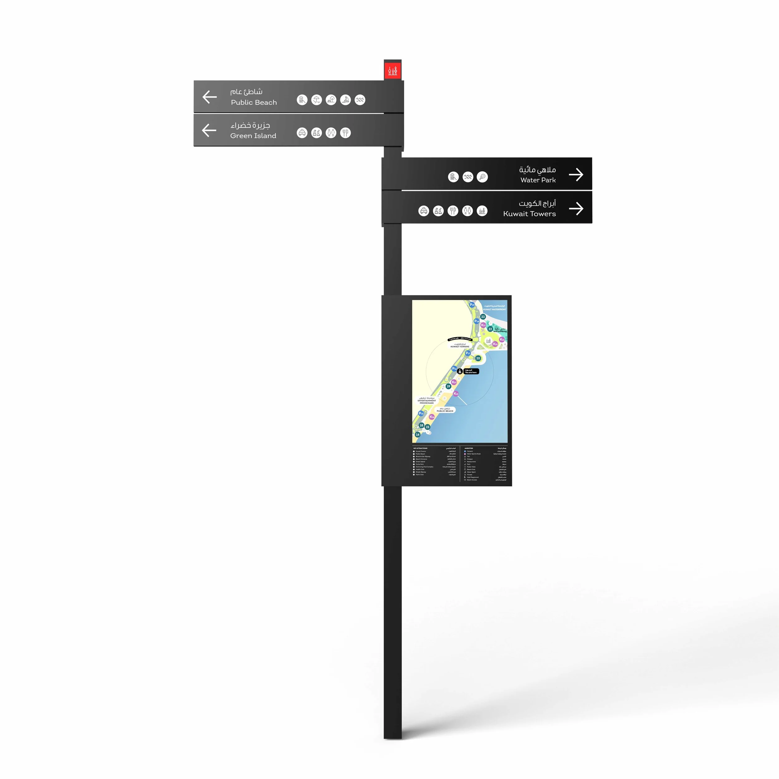
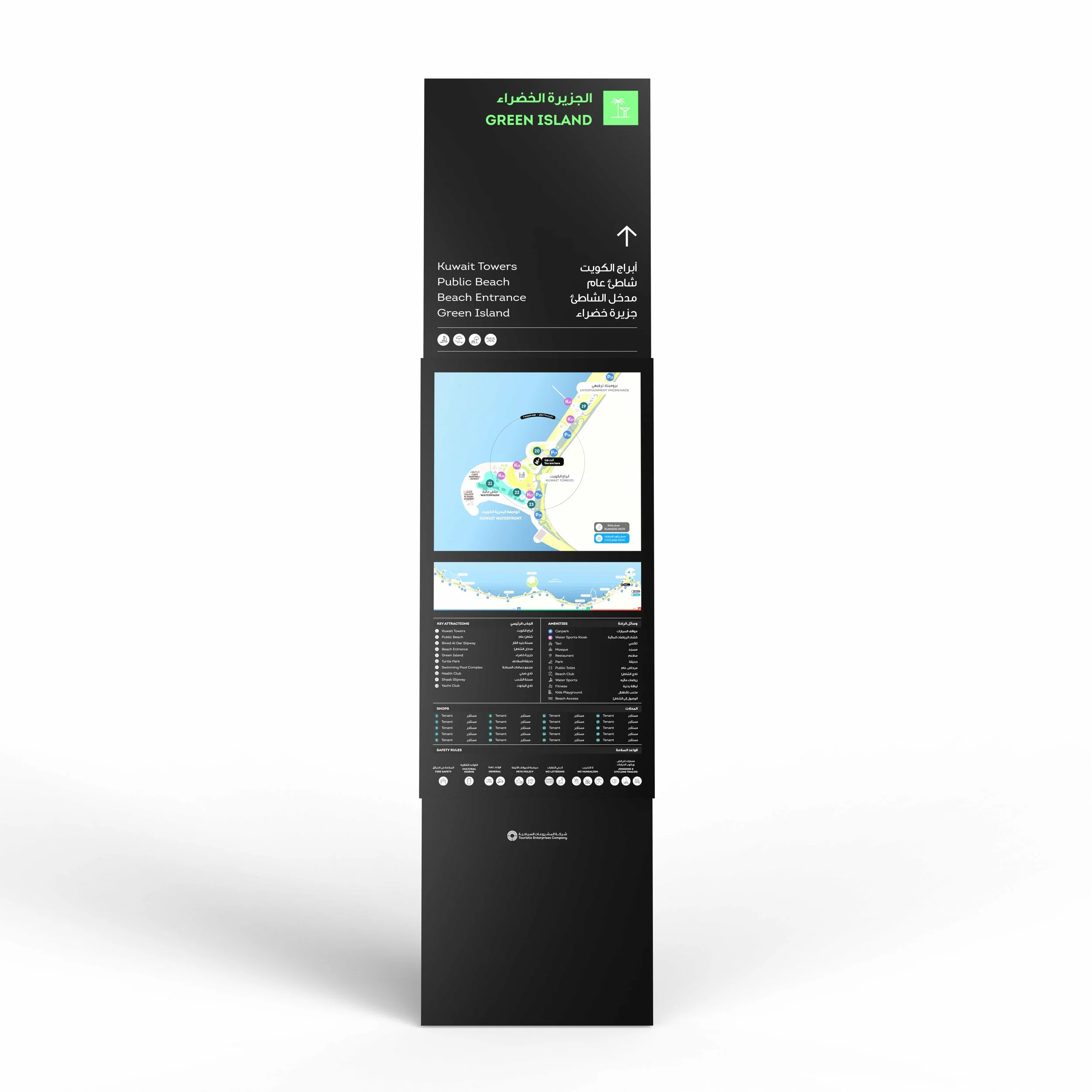
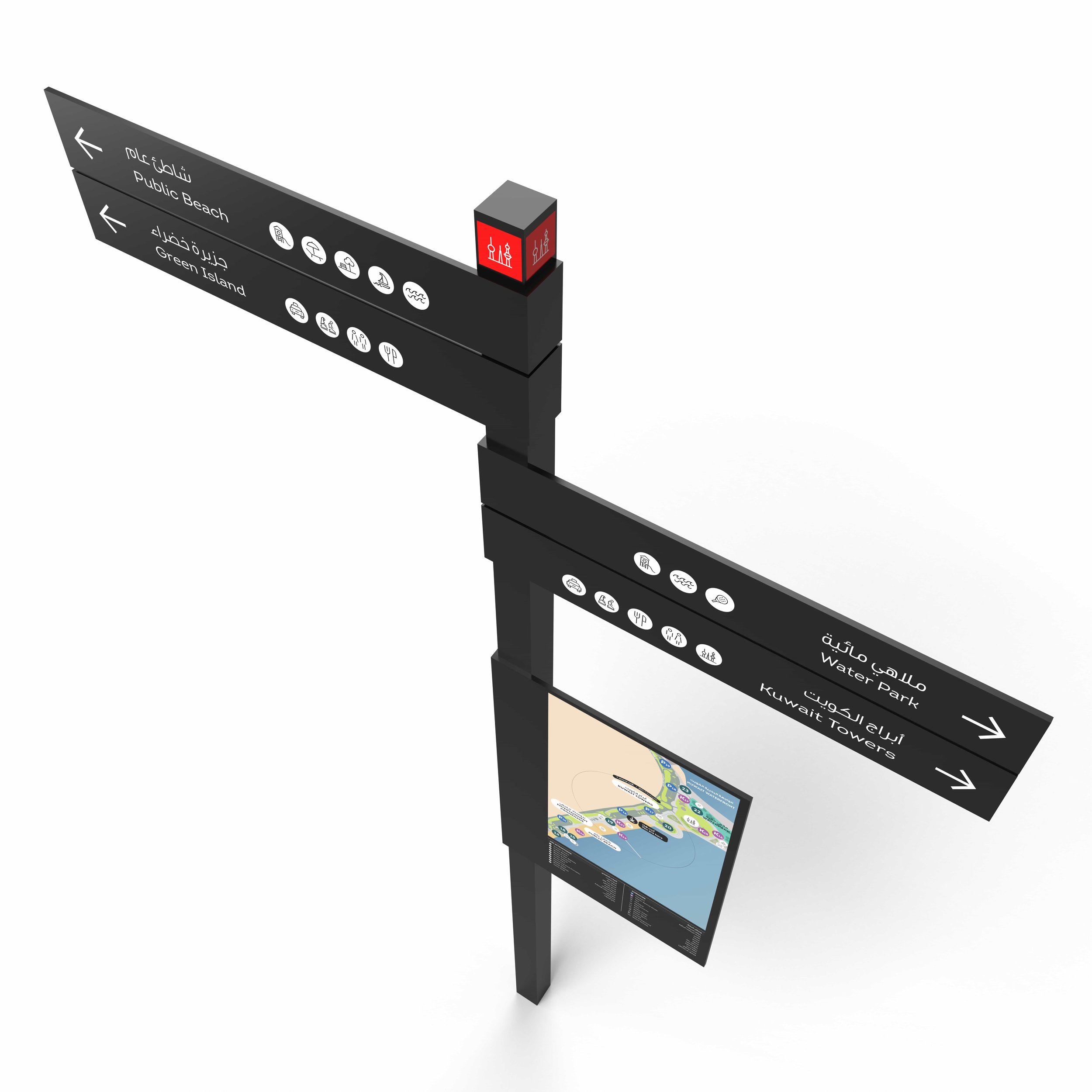
Working across a 10-kilometre stretch of waterfront promenade featuring the Kuwait Towers, Turtle Island, Green Island and a series of major civic and entertainment attractions, the team designed a slender, elongated signage family anchored by beautifully crafted maps that handle macro and micro orientation across one of the GCC's most distinctive coastal corridors.
Expertise: Wayfinding Strategy, Signage Design + Implementation
Sectors: Masterplan, Public Realm, Tourism, Transportation & Mobility
Location: Kuwait City, Kuwait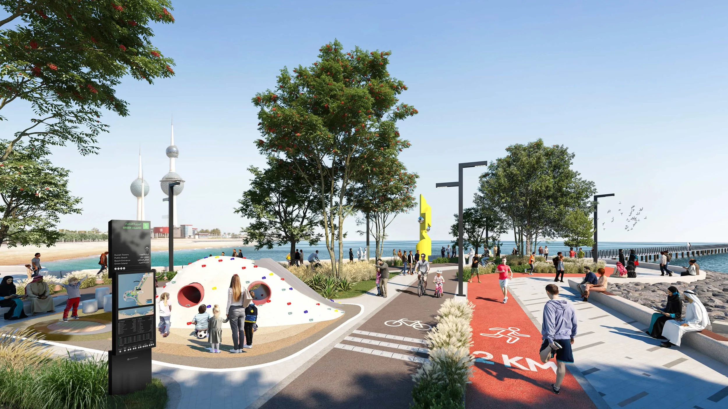
Objective
The Kuwait Waterfront is a 10-kilometre stretch of continuous waterfront promenade at the heart of Kuwait City — featuring the Kuwait Towers, Turtle Island, Green Island, and a series of open spaces and entertainment attractions that anchor the city's civic and public realm identity. The destination is one of the country's most recognisable urban experiences.
Creative Dialog was appointed to develop a new wayfinding programme capable of working across a 10-kilometre linear path with a multitude of attractions, car parks and a large number of potential arrival points — a system that would be intuitive and localised at each touchpoint yet still foster site-wide exploration across the full corridor.
Our Approach
Creative Dialog approached the brief as a visitor experience challenge first and a signage challenge second — recognising that wayfinding across a 10-kilometre linear destination required a strategic understanding of how people perceive and consume the urban realm, not just a pretty kit of parts. The goal was a wayfinding toolkit visitors would look upon as essential, but that was also stylistically unique to the destination.
_We took a deep dive into the intricacies of the destination — understanding how it operates, how people perceive the urban realm, and the multiple different ways visitors consume it.
_We placed visitor experience enhancement at the centre of the strategy, designing for first-time visitors, regular users, and the wide range of arrival modes and entry points across the 10-kilometre corridor.
_We delivered a wayfinding toolkit that was visitor-centric and looked upon as an essential navigational tool — while also stylistically unique enough to function as a recognisable layer of the destination.
_We created a series of beautifully crafted maps that support immediate heads-up wayfinding and orientation for both macro (full-corridor) and micro (local-attraction) scenarios.
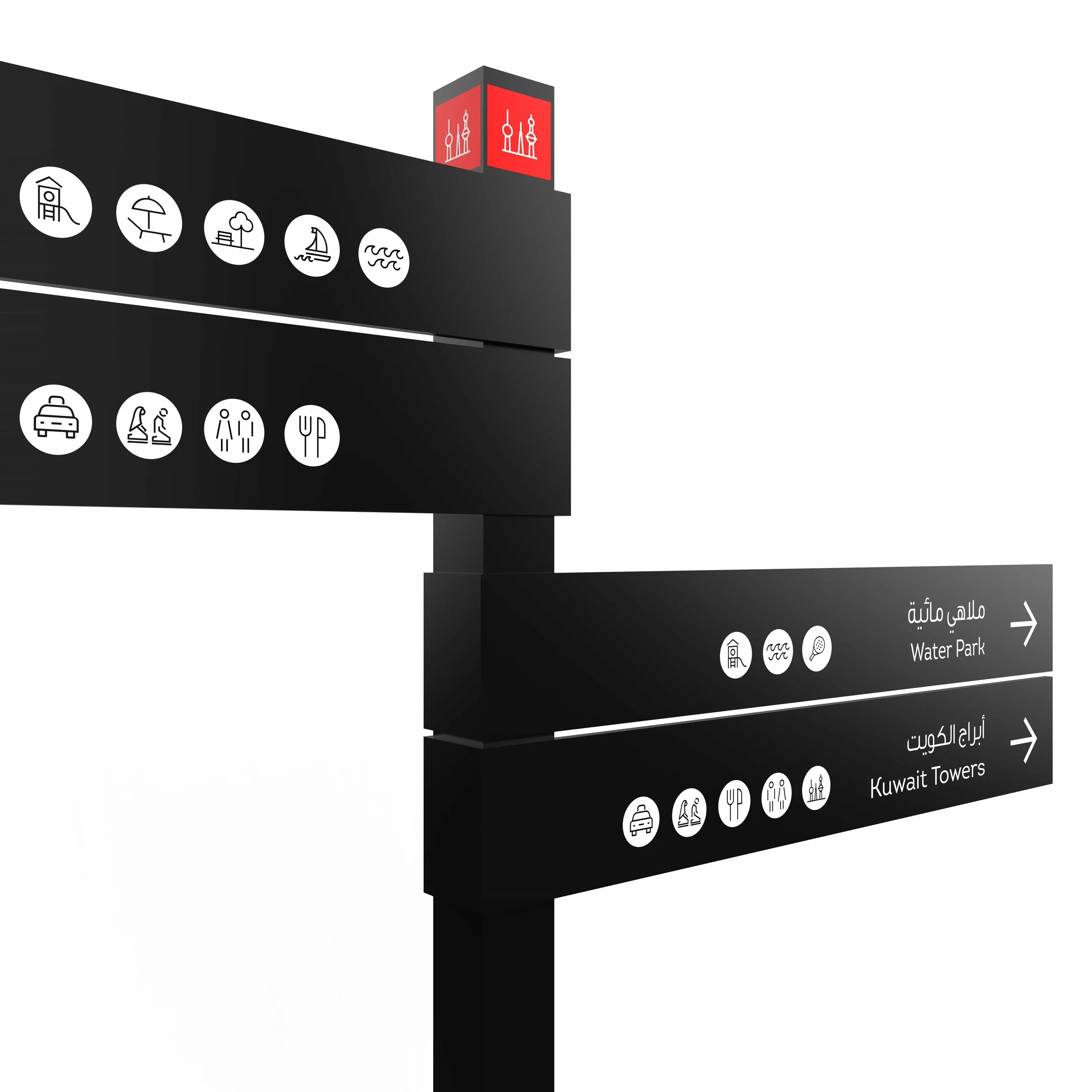
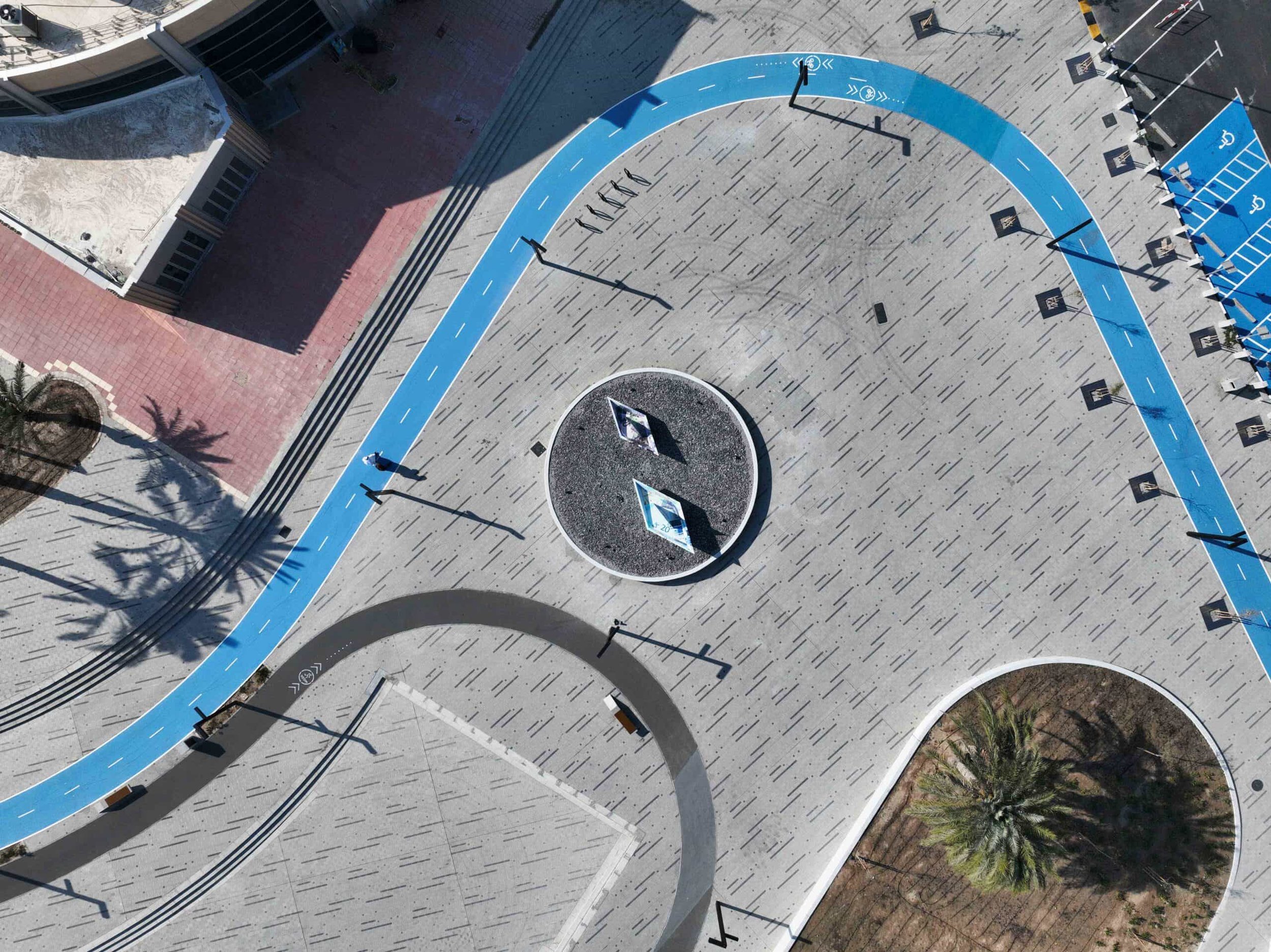
_We designed a purposefully slender and elongated, geometric signage system that complements the varied street furniture and lighting fixtures already in place across the waterfront's public realm and open spaces.
_We delivered the complete kit of parts as bilingual Arabic-English signage with technical documentation ready for fabrication and site-wide implementation along the promenade.
The Outcome
The completed wayfinding system delivers navigation that genuinely serves the scale and character of one of the GCC's most distinctive coastal corridors — slender enough to sit naturally among the existing furniture, generous enough to reveal a 10-kilometre destination at a glance. A public realm wayfinding programme that earns its place in the streetscape.
What We Delivered
Corridor-Wide Wayfinding Strategy
Visitor Experience Analysis
Bilingual Arabic-English Sign Family
Slender, Elongated Geometric Signage Design
Macro & Micro Mapping Suite
Bespoke Orientation Tools
Typography & Pictogram System
Technical Documentation & Implementation Support